Services Statement
We offer consulting, environmental monitoring and application development that helps a diverse range of clients in government, industry, and academia investigate their issues of concern and obtain functional answers.
The solutions are based on applied science and advanced research. Our services and products are specialized in the analysis of marine, freshwater, air, and land resources; computer modeling, geographic information systems (GIS), operational research and data management.
1. 3D Mapping & Monitoring (Indoor and Outdoor)
3D mapping and monitoring of Outdoor and Indoor spaces using new and innovative state of art technology hardware and software. Semantically enriched virtual 3D city models support urban modelling in many ways.
Click here to explore..
We provide solutions in meeting the different standards and for seamless data translation with special reference to the level of details at City level (CityGML), building (BIM) and Indoor (IndoorGML).
2. Photogrammetry and Remote Sensing
We also provide solutions by integrating multiple terrain datasets into one seamless elevation dataset for different environment modeling applications. In addition we provide consultancy services for corridor mapping and inspection works using satellite, aerial and ground based platforms for innovative visual asset management and maintenance. |
3. Natural Resources Mapping
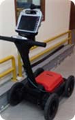 |
We provide solutions on natural resources feasibility mapping through integration of Geological, Geomorphological, Geophysical, Environmental and also the socio economic aspects of specific geographical locations. |
4. Coastal and ocean map services
The services include integration of data sets from observed ( insitu and continuous), predicted and adhoc project information into a single data base with provision on data analytics for trends and patterns, near real time monitoring and alert flagging.

The environmental parameters include wide spectrum of data sets ranging from bathymetry, water quality, surface and subsurface sea bed characteristics.
5. Geographical data capture and Mapping services
|
6. Spatial Data Analytics
|
7. Environmental modeling for Geospatial Risk assessment
|
8. Natural Disaster Hazard and Risk mapping
We offer specialised services focus on natural disaster mapping and GIS based risk assessment with special reference to climate change and disaster risk reduction. Geoscience consulting has the necessary capabilities, tools and technologies to provide solutions for disaster prevention, mitigation, and preparedness.

The team's expertise lies in using scientific methods to identify hazards, assess vulnerabilities, and model the overall impact of natural and man-made disasters. The solutions include Hazard identification, Exposure database development, Vulnerability assessment and Economic loss assessment.
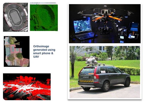 Geoscience consulting team is expertise in generating high resolution stereo satellite imagery for creating various products such as DSM, DTM, 3D building models for different industry sectors.
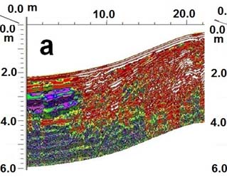 Natural Resources mapping include mainly surface water, Ground water, Mining, Forestry, Ecology and Agriculture resources.
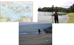 Our mapping services include data capture based on user requirement using conventional, Global Navigation Satellite Systems (GNSS) and Generic Mapping tools. The following services we can offer on:
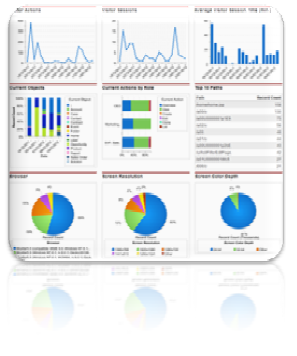 Big and dynamic spatial-temporal data that have been, and continue to be, collected with modern data acquisition techniques such as global positioning systems (GPS), high-resolution remote sensing, predictive Climate and Ocean models require tools on the data analytics to understand the effects over spatio-temporal domain. Our research efforts and services currently focus on the development on approaches, methodologies, and applications to help to understand massive and complex spatial data, to acquire new insights and knowledge, and to better support decision for spatially enabled business intelligency. Specifically, we have been conducting research in the following closely related areas on developing spatial analytical tools, Visual analytics for Met-Ocean data, Climate change ( global and regional circulation models), Urban environment modeling, coastal and marine environment dynamics etc.,
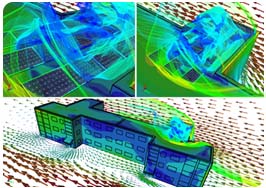 The modern highly urbanized with major tall buildings, tree-lined pedestrian malls, city rooms, sky terraces and roof gardens, the risk assessment of urban wind channels becomes an imperative for sustainable development.
We collaborate the with the Singapore based research and development labs to provide solutions on urban planning analysis, building energy efficiency, air quality & health assessment.